
Comments Off |  Share Article
Share Article 


Dayna Vettese Hello from... on the road somewhere in Kansas!
We're headed home. Today was our last chase day and we played around in the Texas panhandle. There was a lot of potential today but unfortunately there were too many storms all interacting with each other in the area that we just couldn't get a good storm to sustain itself.
So now we begin the marathon journey home... It's about a 24 hour drive from where we were in Texas to Toronto, Ontario. We're going to push it as much as we can but obviously stop if we get too tired. We do have three of us that can rotate driving which is great.
Though our chase trip started and ended strong for us, there was a lot of frustration in the middle! It was a very difficult chase trip from a forecasting standpoint. Every chase day began with morning convection which meant you went to bed thinking one target and woke up to realize, nope, your target is pretty much out of reach for the day. Nonetheless, we did see plenty of tornadoes all in Texas!
Number of tornadoes this trip: 7 (or 7.5)
The sad prt about the trip is leaving a lot of our friends who we typically only see while we're out chasing! Friends from all over the U.S. and even from Australia! We had the pleasure of chasing with Scott McPartland, Dave Lewison, Stephen Barabas, Chris Kridler, Mark Robinson, Jaclyn Whittal, Michel Millaire, Bill Hark, and Daniel Shaw as well as running into countless other chasers we only get to see while out here! Hopefully we'll be back again next year.
All photography from this trip can be found here: Photography
Once I'm home I will begin to edit the abundance of video I've acquired this trip.
Now on to Canada's severe storm season...
Share Article Dayna Vettese Hello from Perryton, TX!
What a day! When we woke up this morning we did not anticipate multiple tornadoes to be in our near future... New photos added here.
We started off in Wichita Falls, TX this morning and decided to target Shamrock, TX then make our way north as storms began to initiate. After stopped in Shamrock, TX, we decided to head a little out of the town to get a better vantage point. Once out of the town we watched a cumulus cloud go from "slightly agitate" to full blown towering and anvil-ing cumulus.
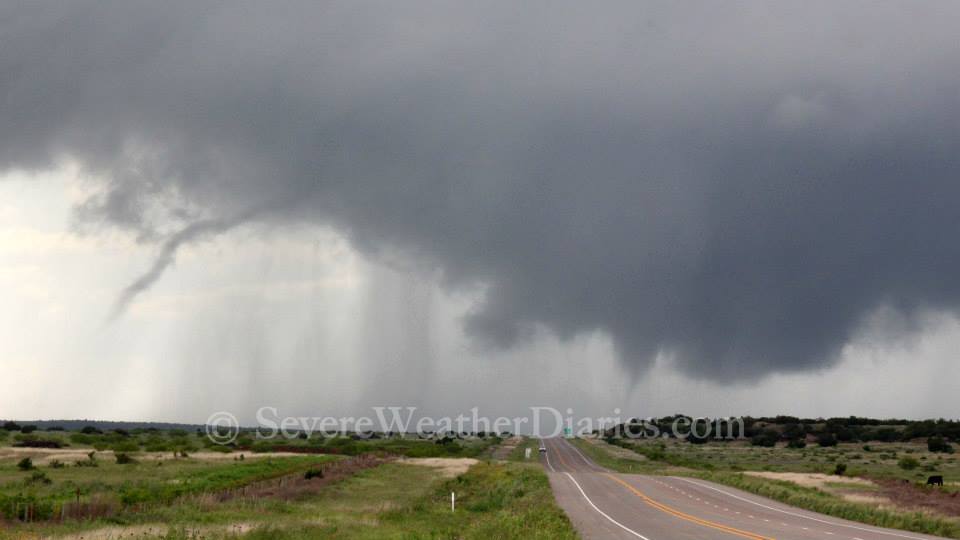
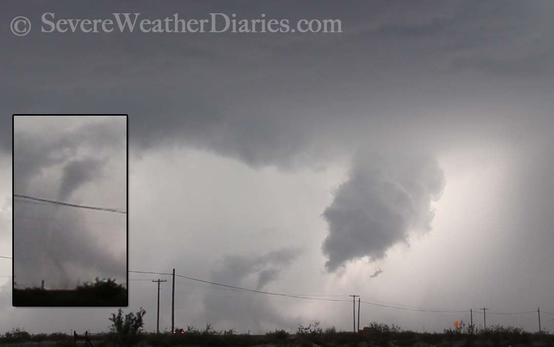
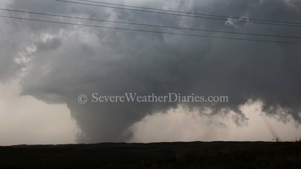
 Turbulent skies near Canadian, TX (May 27).It was starting to show some reflectivity on radar northwest of Canadian, TX (ironically). We drove to Canadian, TX and continued toward the storm on highway 83. It was already very mature and developing a wall cloud. We pulled up and watched. A very impressive wall cloud formed and a funnel emerged. The long, skinny funnel reached about half way down then retreated. The storm did this about three to four times never completely reaching the ground.
The storm started to take on characteristics of it dying (outflow) but it still looked interesting so we kept with it. It was barely moving which was great for us. We decided to reposition to get a better position on the storm. We headed back toward Canadian, TX then turned north on highway 60 and pulled over. It was certainly getting its act together again.
It started to pour so we sat in the vehicle for a bit then noticed a massive cone-shaped funnel forming. The rain cleared and a massive tornado touched down. It started as a large cone then evolved to a wide stove pipe. It became very wide but was not exactly a wedge. Again, the storm wasn't moving so we had a great position and just sat and watched. Eventually it began to rope out and dissipate.
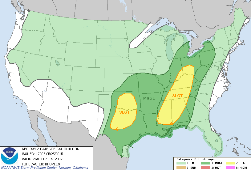
 The Storm Prediction Center's thunderstorm risk for tomorrow (Thursday).
Share Article Dayna Vettese Hello (again) from Wichita Falls, TX!
We could have just left our stuff in the room instead of checking out this morning... We started the day off right here in Wichita Falls, TX. We were in a SLIGHT risk and 5% tornado risk as issued by the Storm Prediction Center. We repositioned a little bit further west toward Vernon, TX and had some lunch deciding that the better environment for storms would be south of the Red River on the Texas side, not the Oklahoma side.
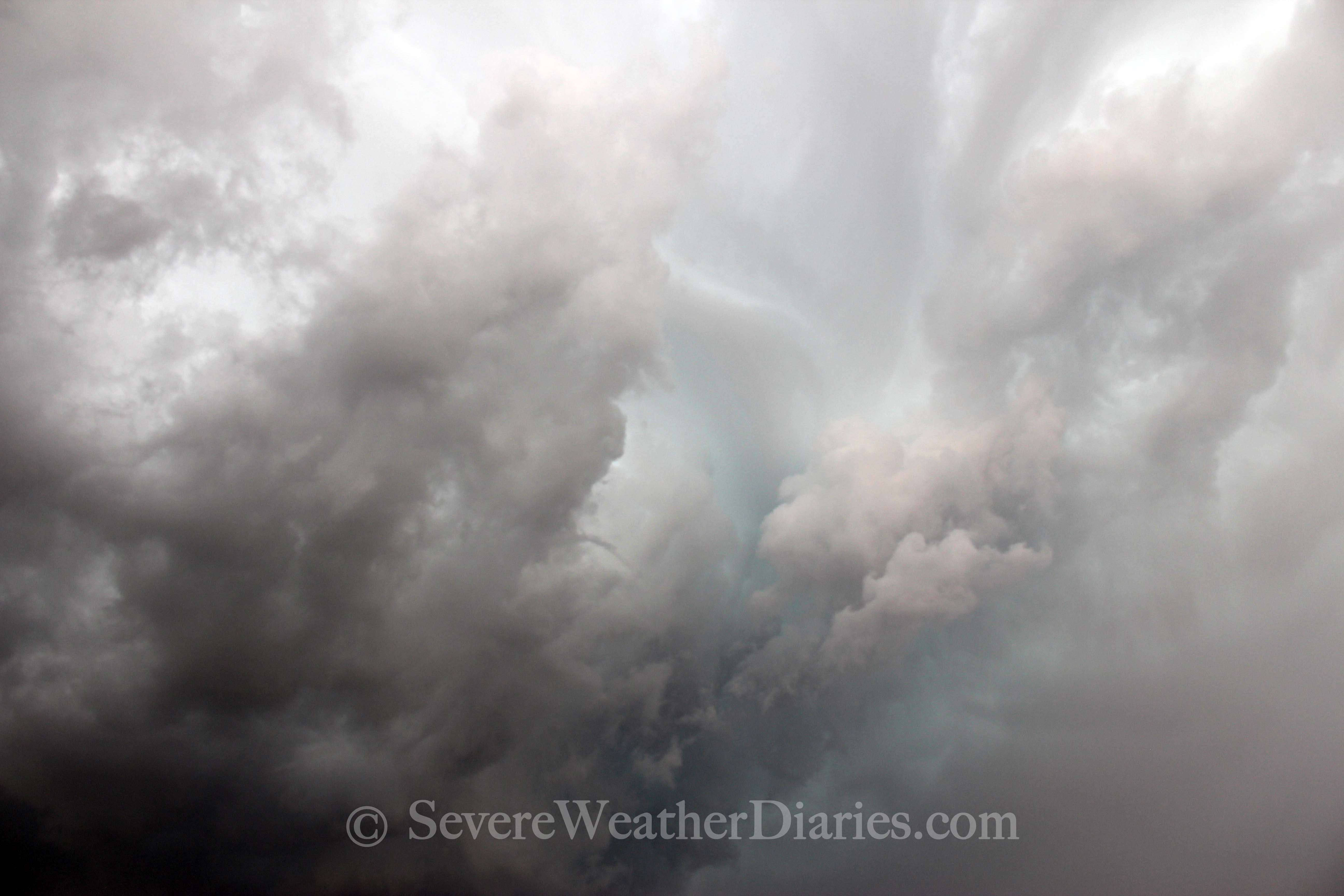
Storms started to pop up and one in particular became very interesting just west of Breckenridge, TX. We started making our way down there. Storms had a lot of CAPE (convective available potential energy) to work with so their development was quite explosive. Unfortunately several storms erupted at once. There was one main storm that was clearly the one of interest but given the poor road network in the area and the bad terrain, it was difficult for us to get on it. As we approached it making our way around it along highway 16 we were seeing images of a very nice wall cloud.
It started to become very evident that this was awful storm chasing terrain. The roads were very windy with a lot of hills and valleys not to mentioned trees and ridges. We could make out the wall cloud on the storm but could not see the ground. We did see inklings of a funnel cloud but again could not confirm if it was on the ground. Eventually, massive amounts of rain and hail started to wrap into the storm. At one point, trying to find ANY good vantage point (which we didn't), we were able to look back toward the storm and see a very defined left and right side of what looked like a tornado back in the rain. Unfortunately, none of us were able to get an image of this. When this occurred we were on a road that lead into Possum Kingdom State Park.
Later we would see images from storm chasers that were closer to the storm and their tornado images looked very much like what we were looking back at as we were driving. What was occurring now was the storm would spit out an outflow boundary then "ride" its outflow boundary south. This caused it to form mesocyclone after mesocyclone in a pinwheel like effect. Effectively this meant the storm just kept diving south and diving south. We positioned ourselves in the town of Tolar, TX with a perfect hail shelter and waited to get cored. Well, of course, as is the case whenever you have a perfect storm shelter, the core dissipated. New photographs added here.
At this point we decided to continue south toward the town of Stephenville, TX. Here we would grab a bite to eat at the Hard 8 BBQ Pit (awesome joint) and ride out the storm then head back to our hotel for the night. Interestingly enough, while we were having dinner, the storm formed yet another mesocyclone basically right over top of us. Lucky for us and those at the restaurant, all it had to offer was strong winds, a lot of rain, and small hail... no tornado.
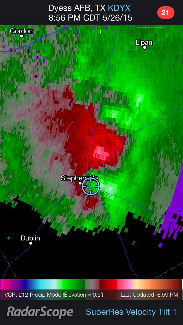 Our position at dinner in Stephenville, TX with meso moving through.
We started our journey back north to Wichita Falls, TX which involved driving through these storms. The rain was torrential and there was pea to marble size hail. We were treated to an incredible lightning show with strikes coming within 30 feet of the vehicle. At one point, lightning struck a transformer near by, we saw it blow and all the lights in the town went out. Cool to see!
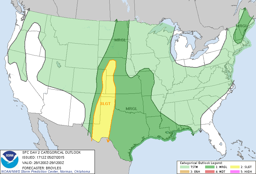
We're back in the hotel and assessing for tomorrow. There is another SLIGHT risk further north into Oklahoma or extreme southern Kansas for a target.
 The Storm Prediction Center's thunderstorm risk for tomorrow (Wednesday).
Share Article Dayna Vettese Hello from Wichita Falls, TX!
After yesterday's disappointment, we woke up today feeling equally as terrible about today. There weren't any clear areas for severe isolated storms but it was evident that a large MCS (mesoscale convective system) would take shape and move across Texas. This would pose even more of a problem for the already mostly flooded state. We headed east and south out of Childress, TX toward Jacksboro, TX. As we were moving along, we decided to salvage the storms of the day, we would position ourselves in Jacksboro, TX where it looked like the strong winds at the apex of the bow echo would come through.
After getting to Jacksboro, TX and scouting the town, we found a perfect location to set up with a lot of sheltering overhangs and sheltered to the wind and rain coming in from the west. We waited for the storm to roll in and it did. The winds weren't overly impressive but it did pour and there was a lot of thunder and lightning.
Once the main part of the storm moved through and we were left with just light rain, we grabbed a quick bite to eat and decided to head to Wichita Falls, TX to stay for the night. On the way we pulled over to do some photography (mammatus clouds with wind mills). Once we got into Wichita Falls, TX, the flooded was evident. Roads, parks, schools under water. We stopped to do some video and photography of that as well.
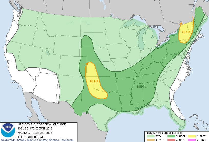
There is the risk of storms tomorrow through Oklahoma so we'll figure out a target tonight then re-assess in the morning.
 The Storm Prediction Center's thunderstorm risk for tomorrow (Tuesday).
Share Article Dayna Vettese Hello from Childress, TX!
Today was... Painful. We started off in Liberal, KS and headed south toward just southeast of Amarillo, TX. There was better flow, CAPE, shear, etc. we waited and waited and storms started to fire in Colorado but stayed where we were.
We blue sky busted in our area. No storms could get going to benefit from the great environment! Then... At sundown, a massive supercell formed in southwest Kansas *just* north of where we spent the night last night. It was night time but a lot of people were on the storm. It dropped a large tornado which eventually became a wedge. This storm went on for a while sustaining itself and cycling. It narrowly missed Plains, KS and fortunately went south of the town of Ensign, KS. Apparently it got very foggy plus the fact that it was nighttime meant visibility was low.
Very happy the towns were okay and congratulations to everyone who saw the tornado last night. It hurts knowing we were there in the morning but you make the best call you can based on the information you have and sometimes it works out and sometimes it doesn't... That's chasing!
Share Article