


May 20 - The Journey Home
And today begins the journey home...
Starting the day off in Ardmore, Oklahoma saying goodbye to our friends as we start our trek back to Toronto, Ontario.
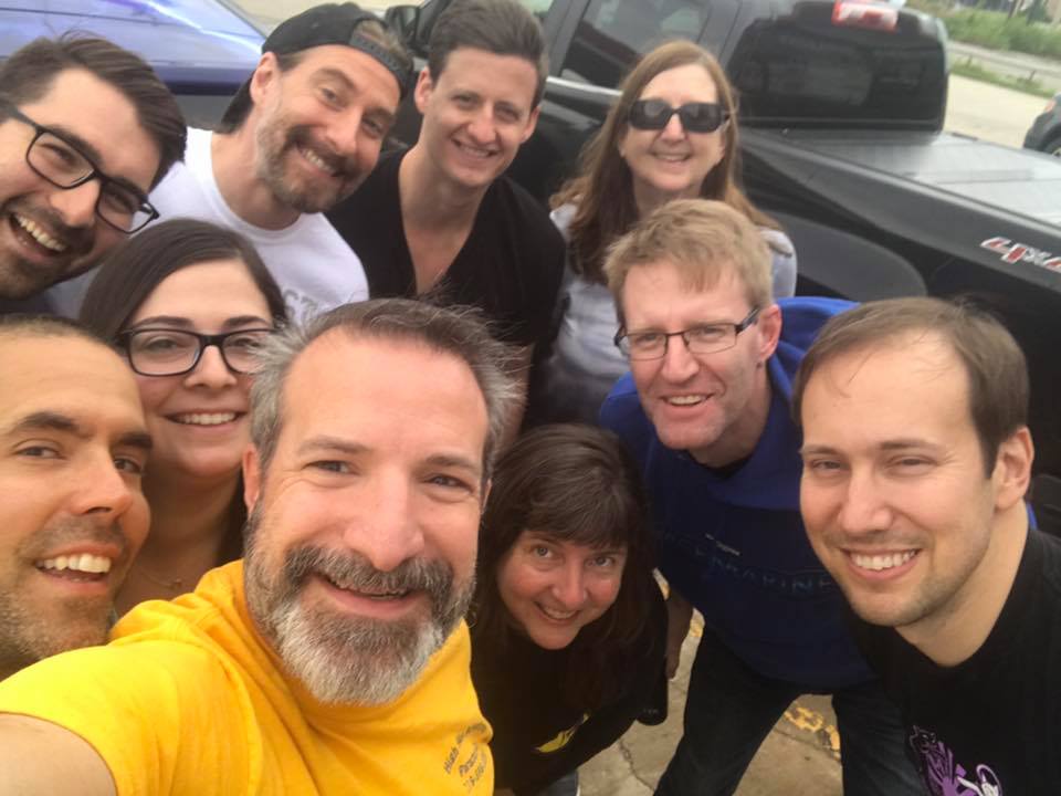 Photo courtesy Dr. Jason Persoff: Our annual chase trip groupie: Brad, Scott, Ross, Kathy, Mark, Dave, Chris, Jason, Yan, and I.
Chase Trip Stats
- Total distance travelled: 7,030 km (4,368 mi)
- Number of chase days: 3
- Number of tornadoes: 3
- McLean, Texas - Tuesday, May 16
- Chester, Oklahoma - Thursday, May 18
- Waynoka, Oklahoma - Thursday, May 18
- Number of states driven through: 8
- MI, OH, IN, IL, MO, KS, OK, TX
- Biggest number of supercells chased in one day: 4 on Tuesday, May 16
- Number of times eating at Subway: 3* *this number likely to go up over next two days
- Number of times driven over the Red River: 4
- Number of birds hit by our vehicle: 3
- Number of fried burritos eaten: 2
- Number of bugs found in our motel rooms: 6* *none were bed bugs
- Number of sudoku completed: 13* *this number likely to go up over next two days
 Dayna Vettese
May 19 - Weird Storms Near the Red River
Hello from Ardmore, Oklahoma!
We started the morning in Blackwell, Oklahoma and had a tough forecasting decision to make: chase in Kansas or south of the Red River in Texas. Two targets were east of Childress, Texas south of the Red River or in and around Medicine Lodge, Kansas. The Kansas area had great shear but there was a question of whether or not we could get enough instability up there. The Texas area had great instability but moderately favourable shear environment. In the end, the Texas target was agreed upon on our group so we headed south.
We got on a cluster of storms just south of the Red River near Henrietta. It showed some promise but was certainly struggled so we tracked it north back across the Red River toward Wilson, Oklahoma. Those storms died out and more were developing to the south so back we went, across the Red River again, toward Henrietta... tracked those north and they too died out. The storms in our area would build up, produce a wall cloud, then completely disintegrate. After all that, we called the chase, headed back across the Red River again to spend the night in Ardmore, Oklahoma.
We got the whole gang together and ate at a restaurant in Ardmore. After we paid, we got an alert that our area was under a tornado warning and sure enough, a rotating storm was headed for our area just north of our location. We packed up and headed just north on the I-35 for Springer, Oklahoma and let the storm come to us. By the time it arrived, it had lost all its rotation so we called it a night. Looks like Friday was our last chase day and we'll be starting the journey home on Saturday.
May 18 - Tornadoes in Oklahoma
Hello from Blackwell, Oklahoma!
We saw two tornadoes today in Oklahoma and some fantastic structure.
We started the day off in Sayre, Oklahoma and the NWS SPC had issued a HIGH RISK and 30% hatched for tornadoes today. It was a difficult forecast because we were really torn between three options: warm front, dryline in northwest Oklahoma, or dryline in southwest Oklahoma. We decided the northwest Oklahoma dryline would be our play.
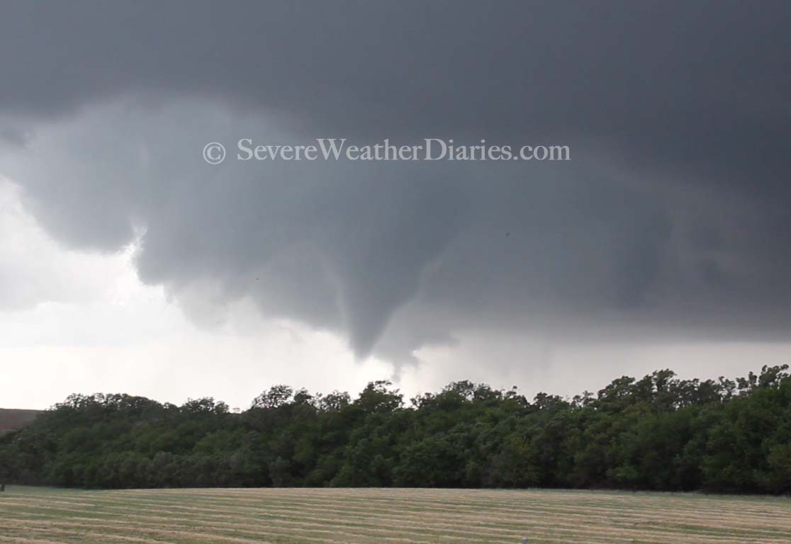
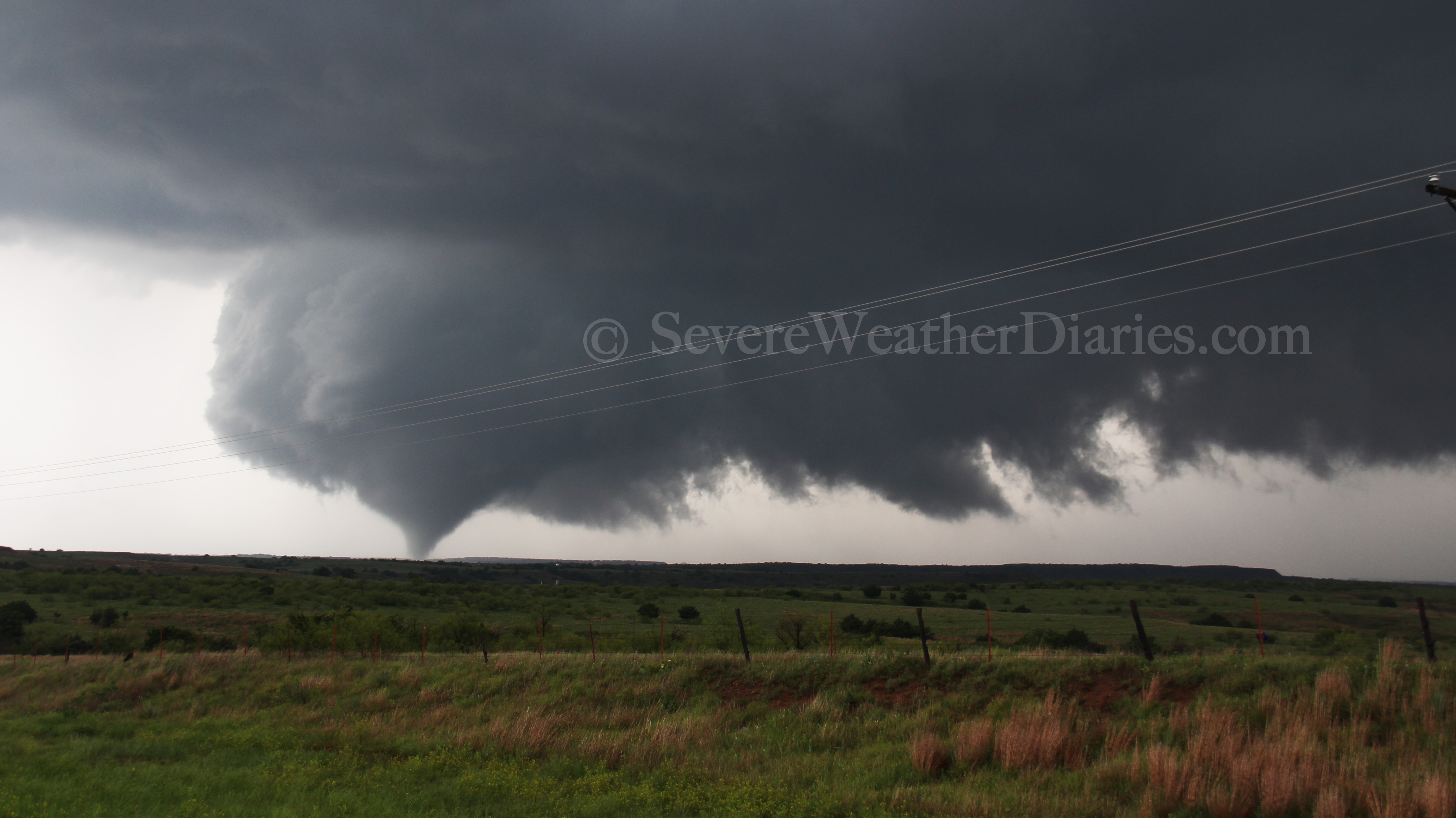 Tornado between Chester and Waynoka, Oklahoma on May 18, 2017.
We drove to Shattuck, Oklahoma where we spent time pouring over models and watching radar and satellite. The storms way to the south in southwestern Oklahoma started producing tornadoes which stressed us out a bit. We headed for storms firing just south and east of us and watched. The initial storms we were on were struggling to we headed for a storm just south of Waynoka, Oklahoma. As we were getting into position on the storm, out view of it was being obscured by hills to our south. We finally found a good vantage point and as we pulled over, we saw a tornado in its dissipating stages as a new wall cloud was forming to its northeast. The new wall cloud was rotating rapidly and we watched it for a while before repositioning farther west on the road. As we pulled to the top of a hill, we watched the tornado form. At its base, we could see it tearing up trees. We followed it for a bit before it eventually dissipated.
We decided to leave this storm for storms farther south. We headed down near Seiling and followed it up toward Meno, Oklahoma. It did look promising for a while with a beautiful bell-shaped updraft but it just couldn't keep its act together. It did produce some beautiful structure that we were able to photograph.
We had a quick dinner and are now spending the night in Blackwell, Oklahoma. Tomorrow looks like a play in southern Oklahoma, likely south of the I-40 toward the Lawton area. We'll reassess in the morning. Currently, the NWS SPC has an ENHANCED RISK out for tomorrow with a 30% hatched for severe.
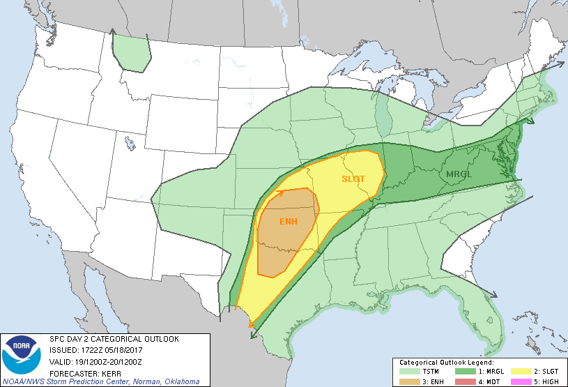 NWS SPC Day 2 Categorical with an ENHANCED risk (valid for May 19, 2017).
May 17 - Forecast for May 18 Risk
Hello from Sayre, Oklahoma!
We started the morning off in Lawton, Oklahoma after a terrible stay (never, ever stay at the Days Inn in Lawton... Better yet, just try not to stay in Lawton at all unless you stay in one of the expensive hotels). Tonight is a completely different story! We're staying in the AmericInn right off the I-40 in Sayre, Oklahoma and it is a gem! Newly renovated, beautiful rooms, awesome staff, and even a bar!
Okay... enough of that.
We decided to retrace the path of the Elk City tornado and take a look at the damage caused. It took us to the south side of Elk City where the worst of the tornado damage was done. So far, the NWS in Norman, Oklahoma have only tweeted that they found EF2 damage but no official rating has been given. From what we were able to see it looked like high-end EF3 damage but we'll see what the official assessment says. Unfortunately there was one fatality (among other injuries as well). The Red Cross is here helping out and what looked like the entire community was out helping those affected clean up and recover.
We went for dinner to get our steak for correctly forecasting and chasing a tornado yesterday and we went to a local restaurant in Sayre called Rodriguez's Steakhouse... It was incredible! Wow, some of the best steak I've ever had.
Alright, on to tomorrow's risk: The NWS SPC has issued a MODERATE RISK for severe storms tomorrow including tornadoes and "a strong tornado or two is possible, particularly across parts of southwestern Kansas and adjacent northwestern Oklahoma late Thursday afternoon and evening." Also curious to see if the SPC upgrades to a HIGH RISK for tomorrow as the parameters do seem to be in play for that.
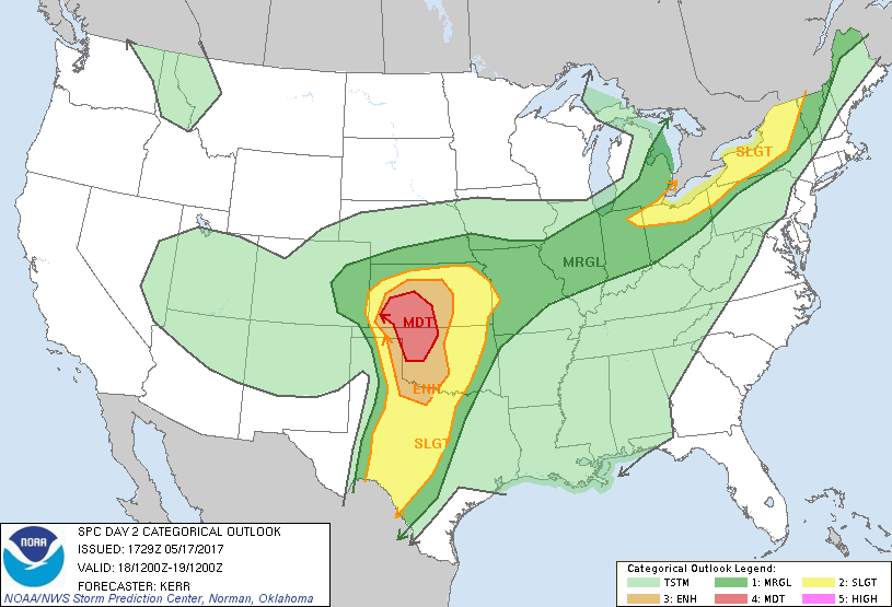 NWS SPC Day 2 Categorical outlook with a MODERATE RISK (valid for May 18, 2017).
As for our forecast, the question is whether to play the warm from into Kansas or the dryline push. Currently we're favouring the dryline as it has the potential for more discrete and visible storms rather than the warm front which could produce tornadoes but hard to see due to high precipitation potential. We will likely position about an hour or so north of here tomorrow and reassess as the day progresses. A surface low will develop in southeast Colorado with a dryline extending into southwest Kansas and western Oklahoma. Low level shear parameters along the warm front are a lot better but they may be more short lived. The dryline storms have the potential to be longer lived. So the ultimate question is... Do you play the warm front with the amazing parameters and great backed winds but risk these storms being high-precipitation, short lived, and less visible or do you play the dryline with fairly good parameters but the potential to be more visible and longer lived? The chaser's (and forecaster's) conundrum...
May 16 - Tornadoes in Texas & Oklahoma
Hello from a thundery Lawton, Oklahoma!
We saw our first tornado of the trip south of McLean, east of Howardwick, Texas.
We started the day off in Woodward, Oklahoma and forecasted an initial target in and around the Shamrock, Texas. We waited in Shamrock until initiation as storms went up to our west and repositioned just north of McLean, Texas on the 273. From there we watched a supercell mature but it seemed to be struggling as a storm building to its south so we decided to position ourselves south of the I-40 and watch this supercell grow. Due to some terrain issues we had to keep moving around on the 273 to find a spot that wasn't blocked by trees and hills. We finally found a good position and watched the wall cloud form, then the funnel, then eventual tornado. The image below is a quick screen grab from our video of the tornado as it was initialy touching down. After a few minutes the tornado became wrapped in rain so we moved slowly north on the road anticipating it to either get near to or cross the road. Eventually the tornado re-emerged from the rain as it was roping out. We watched it rope out then we had more decisions to make because other storms were maturing and taking shape.
 Tornado near Howardwick, Texas on May 16, 2017.
A storm south near Sayre, Oklahoma was maturing and looking tornadic so we moved east along the I-40 and dropped south to get into position. This storm had a beautiful bell-shaped updraft and was visually stunning but the "business" part of the storm was wrapped in rain from our vantage point. We watched the storm move past us but because of our positioning on it, we had to approach it carefully, travelling east, from the west side of the hook. Due to the fact that this was so high-precipitation we decided to stop and wait for the circulation to cross the road. Unfortunately, the tornado was doing a lot of damage so the local emergency managers shut down an east and southbound road which left us losing positioning on the storm. Since there was no way for us to make up that time, we decided to drop south again to another storm that was forming. The storm we were leaving was producing a very large tornado but it was wrapped in rain and we couldn't see anything. This eventually moved into Elk City and caused quite a bit of damage.
We moved south to the far south storm but by this point, the cap was building back in and the storms starting to die out. We called it a day and decided to head to Lawton for the night.
Today is a down day and we're moving closer to the I-40 corridor again to setup for tomorrow's chase. The NWS SPC has already issued a MODERATE RISK for severe storms tomorrow (below) so another big chase day ahead for us.
 SPC Day 2 Categorical Risk (valid for Thursday, May 18).