


First Chase Day of 2011
Good morning! We're currently at the Guest Inn in Norman, Oklahoma looking at the newest models. Brad, the Tornado Whisperer, if dissecting all the information and trying to decide a target for today. The good news is all the targets we're debating between are all within a couple of hours of where we are. Not to mention Norman has highways coming out of the city in every direction which makes it easy for us to get going where we need to. Today looks good for storms. The next couple of days look even better but here's some of the text that the National Weather Service's Storm Prediction Center is saying about todays storms:
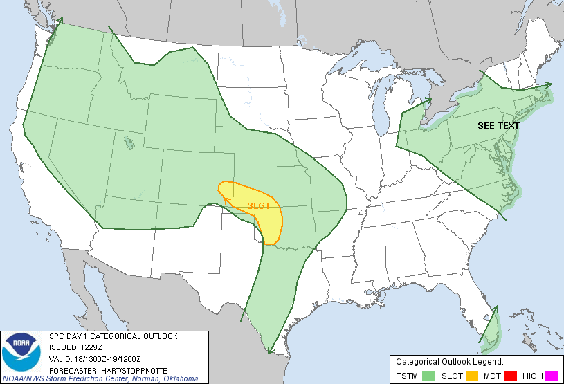
...THERE IS A SLGT RISK OF SVR TSTMS FROM WESTERN OK INTO SOUTHEAST CO...
...CENTRAL/SOUTHERN PLAINS...
...THE SURFACE DRYLINE WILL BECOME WELL-DEFINED OVER WESTERN OK AND PROVIDE THE PRIMARY FOCUS FOR ISOLATED SEVERE THUNDERSTORM BY LATE AFTERNOON/EARLY EVENING.
...OPPORTUNITY FOR DISCRETE THUNDERSTORM/SUPERCELL DEVELOPMENT OVER WESTERN OK BETWEEN 23-03Z. ANY STORM THAT FORMS IN THIS ENVIRONMENT WILL POSE A THREAT FOR VERY LARGE HAIL AND A TORNADO.
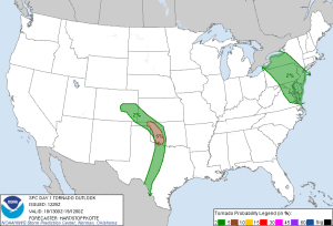
Here are some of the images for risks today:
Convective Outlook
Tornado Probability
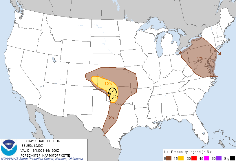
Hail Probability
So we're probably going to hang around here until about noon then head out probably towards Kingfisher, Oklahoma and then from there, based on surface observations, radars, and satellites, decide where we need to go. We'll also be meeting up with Scott and Dave who were in Joplin, Missouri this morning and are making their way here to chase. Will update when I can throughout the day but it gets difficult to update while chasing. It may be easy to tweet for a while then update tonight.
 Dayna Vettese
Reader Comments