Comments Off |  Share Article
Share Article 


Brad Rousseau After having a couple of tough first chase days I'll take a look at what the current situation is and a look at the next few setups in the week or so to come. Our first two chase days were tough. May 9 was our second travel day which we usually won't chase on but rather get into position for the next days chase. But given it was a moderate risk as per the SPC and was within distance for us to get to we had to give it shot. But the early start to the convection killed the chances we though there was for southeastern Kansas and we ended up chasing a messy little cell near the OKC metro. Already breaking the rules I set out for myself.
Our first full chase day on May 10 was frustrating as well. Early morning convection had essentially ruined the environment for the risk area and split it in two. We saw the outflow boundary that surged south out of the morning convection into Texas and expected it to continue to push southward ultimately ruining the environment. An oversight that I had made was the fact that the sun was out and was able to 'cook' the boundary which allowed it to slow down and stall along the TX/OK border. This resulted in some nice supercells and a destructive tornado. We chose to head into southwestern Kansas where we thought the clearing was going to be enough for the environment to recover. But ultimately the heating was not enough. Storms did initiate but struggled to to mature.
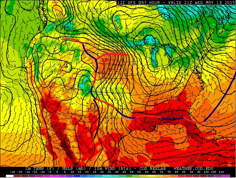
Today is the first of two down days. Looking at the the 500 mb and the surface chart below we can see why. An area of high pressure has setup over the central U.S. thanks to the upper (500 mb) trough pushing off to the northeast with an upper ridge centered over the western U.S.
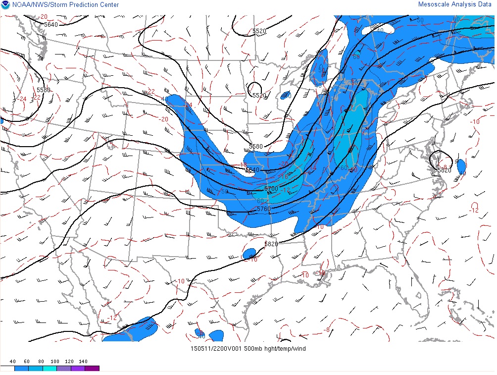
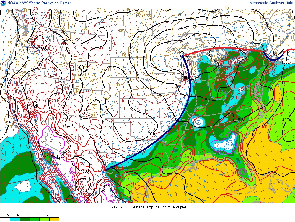
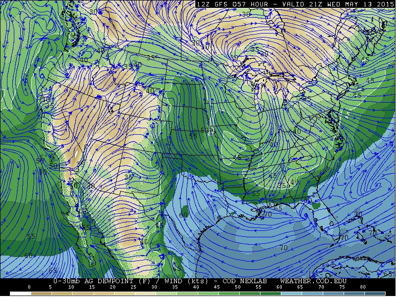
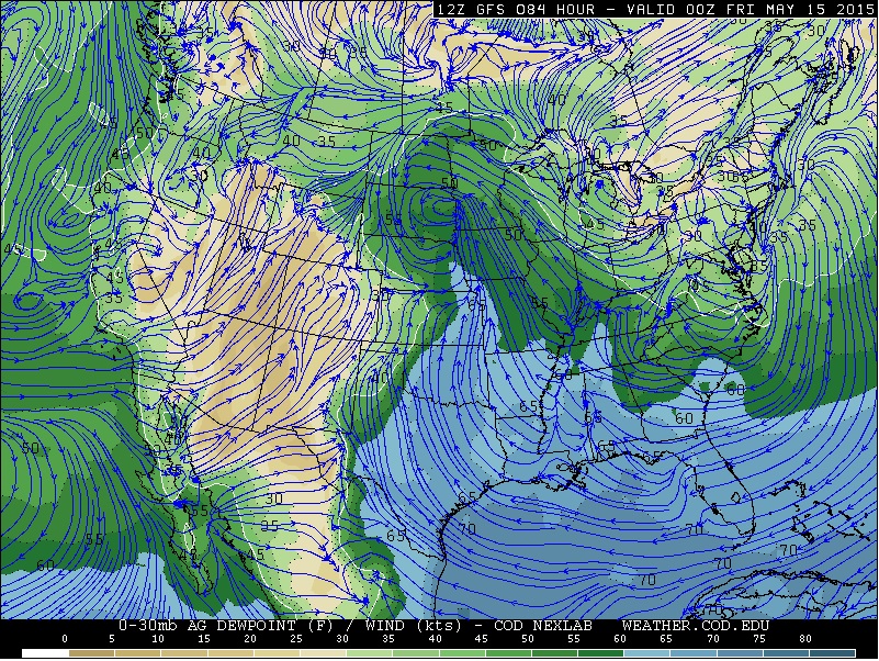
Thanks to this scenario we can see that the surface front has reached all the way to the Gulf shores with the warm, moist, and unstable air getting into the eastern U.S. and into southern Ontario. The second image below shows the meso analysis of the moisture and current fronts. Take note at how the surface cold front has shut down all moisture from the Gulf .
I'm going to skip over Tuesday since high pressure will remain in place and is expected to be another down day. Wednesday looks to be our next potential chase day, although there are still many unknowns and will have to wait until tomorrow to make the final call. The setup is as follows
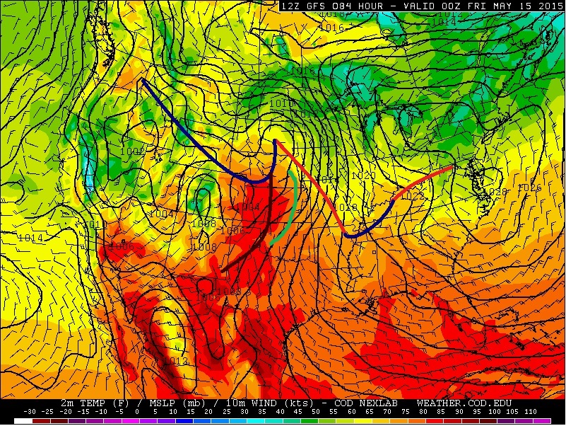
At 500 mb most models have a weak trough ejecting into the Texas panhandle. Note that I will use the GFS just to give visuals of the forecast just for consistency from the medium to long range as I cannot post the ECMWF forecasts and the NAM ends but Thursday evening. I will discuss the other models howsoever. For Wednesday there is good agreement with the upper pattern but there are some timing issues. The ECMWF is a little fast ejecting the trough early afternoon where the NAM is lagging a little behind the GFS. This is system is likely to be what is refered to as a "sacrificial system". This means that will will draw the front northward allowing warm moist Gulf air back into the plains. As the front is drawn northward through the day early showers and thunderstorms are possible which would ultimately kill any strong storm potential unless the precipitation can clear early enough to allow the atmosphere to destabilize.
At the surface we can see how the frontal boundary is beginning to push back north which is allowing the Gulf moisture back into Texas. In response to this trough is a weak surface low along the New Mexico / Texas borders where a weak and subtle dryline looks to mix eastward. SHOULD there be enough clearing or little morning showers than the area along and south of the warm front and along / ahead of the dryline could produce the risk of a few thunderstorms. The weaker flow aloft will not produce a tone of shear but current numbers are just on the lower threshold for weak supercells.
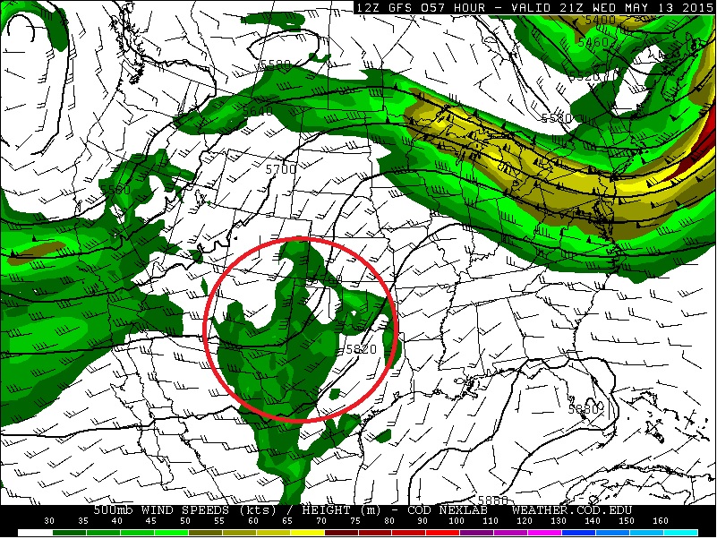
Starting again with 500 mb the trough for Thursday ejects into the NE / SD / IA regions with a broad upper low and speed max pushing into the Pacific coast. The ECMWF / GFS have good agreement with the setup with the NAM a little more meridional with the flow associated with the upper trough over the northern Mid-west. 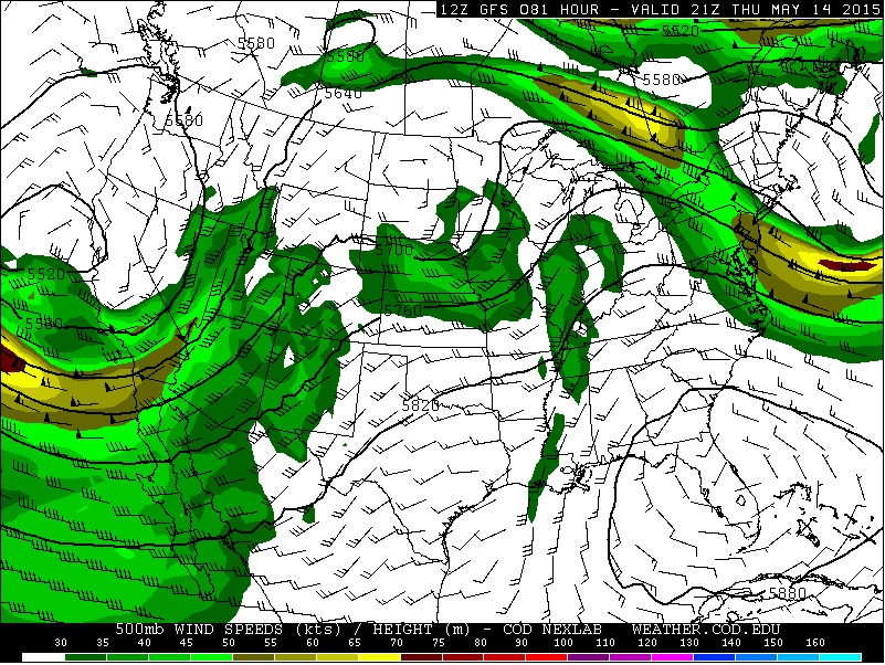
At the surface the warm front will push into the north central Mid-west with a weak dryline likely to push into western Kansas and possible into western Oklahoma. The green line is where the GFS looks to have a confluent axis draped across southeastern NE, eastern KS, and into northern and western Oklahoma. Under the stronger 500 mb flow both the NAM and GFS have little CAPE. But along the southern end of the confluent axis in southern KS and into OK and along the dryline in OK the NAM and GFS are showing 2500-4000 j/kg of SBCAPE. I will note that within the moisture fields the NAM and ECMWF do have a better dryline surge into western OK. The down side here is there is weak flow aloft but wind profile do have sufficient veering winds. Its difficult to pin point where convection will be but it is possible that both the confluent axis and dryline have a low chance of producing some thunderstorms. The hope here is that the big CAPE will allow for updrafts to stretch the column so that any shear can really be enhanced. But again this is a very low risk for the time being.
I'll leave it this for now and I will touch on the weekend potential tomorrow as a severe weather outbreak is possible for the upcoming weekend May 15-17.
Share Article