


May 16 - Chase Day, Morning Update
***Update***
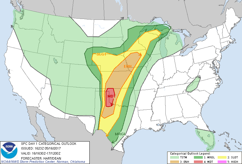
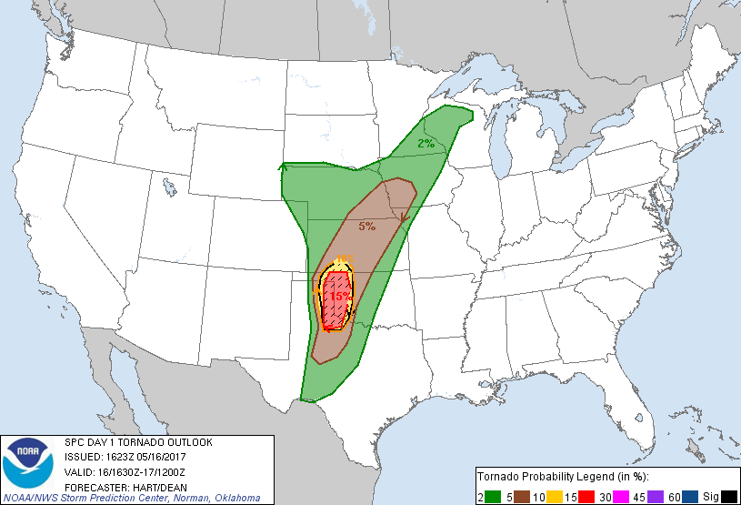
The NWS SPC has upgraded to a MODERATE for today with a 15% risk for tornadoes.
-------------------------------------------------------------------
Hello from the road...
Just left Woodward, Oklahoma on our way south toward the I-40 corridor. We plan on heading that way toward the Texas/Oklahoma border and re-assess our target for the day.
As for today's forecast:
Strong upper level winds and low level shear with plenty of energy to be had is the recipe for today in western Oklahoma and the eastern Texas Panhandle. There is a long meandering dryline that will be the focus point for initiation today but the trick is to pick the right spot along the dryline. The strongest forcing along the dryline is progged to be in the eastern Texas Pandhandle and western to southwestern Oklahoma. This is where we believe, based on forecast soundings and hodographs, some discrete supercells will form later today.
 SPC Day 1 tornado probability for this afternoon and evening (valid for May 16, 2017).
There is some concerns due to the wind profiles because we are noticing a veer-back-veer profile in the winds which often times can inhibit tornado genesis or lessen the risk for tornadoes on a day like today. Nevertheless, this concerning profile pattern looks to be above 3 km which shouldn't impact the surface-based storms too much.
The biggest risks today will be very large hail, strong winds, lightning of course, and the possibility of tornadoes.
If you would like to follow along with us, again, we'll be on Twitter, but if you use SpotterNetwork, you can look for "Brad Rousseau".
 Dayna Vettese